"The Eternal Simulation Project"

—2019

Model_12.jpg
 

The Eternal Simulation Project is a report from the U.S. Department of the Interior regarding a theorized model: a model of a table, that is a model of a room, that is a model of a building, that is a model of a region. Proposed as a recursive public engagement tool by the Bureau of Reclamation, the model simulates multiple scales of space and time the Bureau functions across for allocating water rights to subjects within the Colorado River Basin.

Drawing_1_Site Plan Small.jpg
Drawing_2_Building Plan Small.jpg
Model_2_Scaling Model.jpg

A model of a model of a model of a model

Model_7.jpg
Model_9.jpg
Model_10_Interior Small.jpg

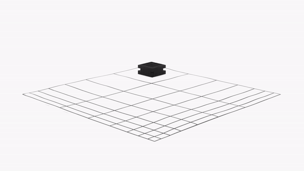
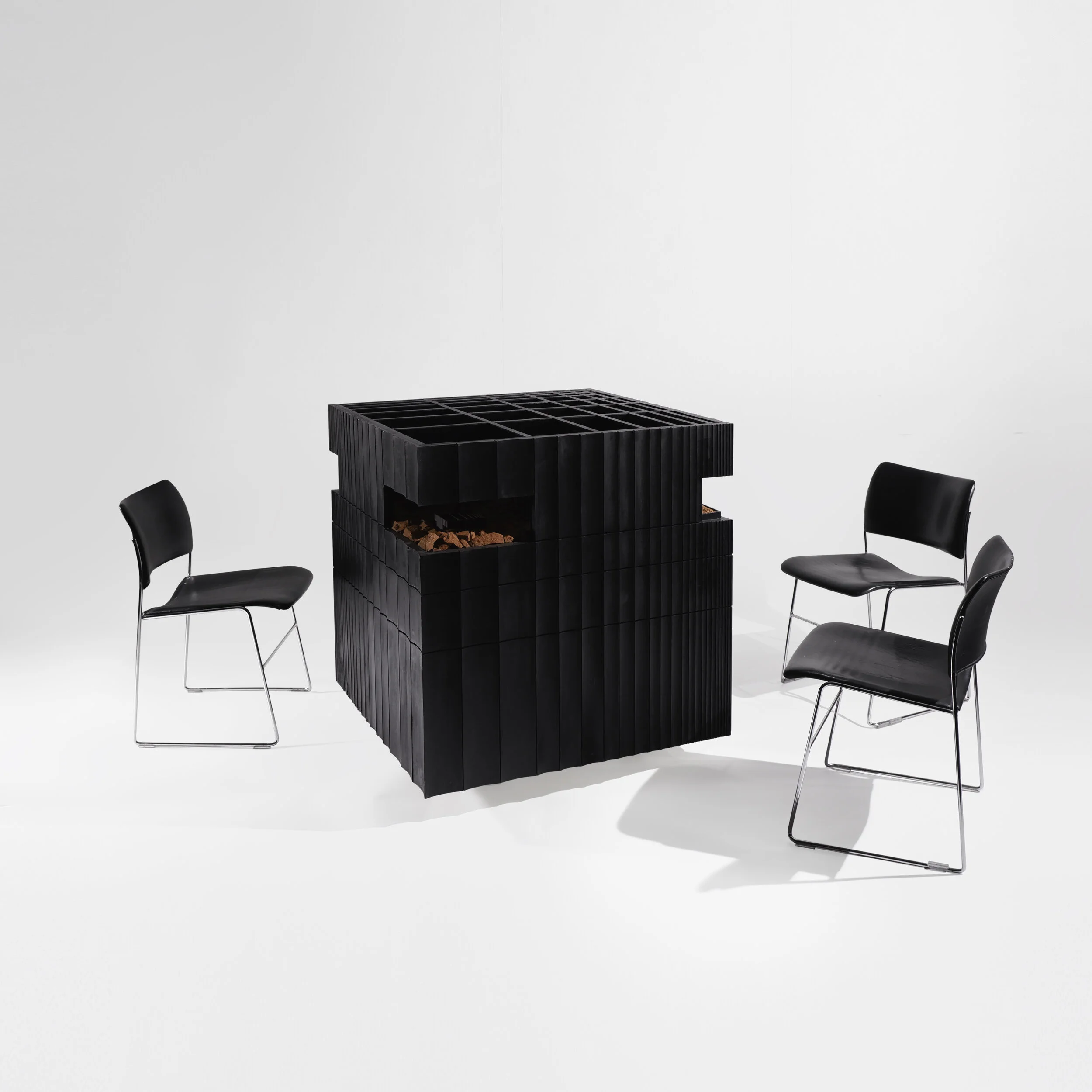
At the first and most concrete level, the simulation functions as a forced perspective with subjects entering along its axis at the building entry to negotiate. Subjects proceed to a table that is a model of the building they are in (and a model of the model room they can see in front of them). On this axis, the subject is provided a flattened view of the simulation with all objects and landforms reduced to a single scale. From this perspective, the representation feels understandable, controllable and easily debated. The Table, Room, Building and Region all align as one representation. The subjects can negotiate and move their artifacts within the table, insinuating changes to take place within the room, the building and the region at large.

 
Model_11_Interior Small.jpg

Off-axis however, the representation warps apart as scale is revealed to the individual. What appeared understandable and controllable suddenly feels complex and unwieldy. The multiple scales of representation suddenly separate and expose the leap we take in projecting our simulations outward. Further, the wandering subject recognizes their own objectification within the landscape while under the gaze of other subjects still on-axis, still under control of the flattened perspective at the negotiation table.

 
Landscape GIF.gif
 

At a second level the project functions as a simulation of its own failure. The entire simulation enclosure as a building sits upon an exposed and unconstrained earthen floor which undulates and redeposits soil due to local hydrological conditions. Placed both adjacent to the Colorado River and a perpendicular fluvial runoff, the simulation is consistently subverted by the landscape, undermining the measurement of spatial and temporal processes required by the Bureau. Artifacts considered old might appear new when exposed by moving soil, artifacts considered new might appear old, blurring subject’s perception of accurate time.

 
Model Gif.gif
 

At a third and final level the project functions to conflate simulation with reality altogether. As subjects sit at the negotiation table, they witness the table’s interior as model of the building’s interior they are also in, and that in front of them, the model room exterior they see across the building matches the table exterior directly in front of them. Within the model room is another model of itself, yet at the same scale as the table the subject sits at currently. Remembering their approach through the site, it too matches the layout of the building, the model and the table. The simulation then, is forever scaling inward. Could it also be forever scaling outward? The subject is forced into an uncanny recognition of their own simultaneous position at multiple scales of space and time within an unbounded model. Ultimately, the subject may use this recognition as an act of empowerment; they may demand that the simulation they produce within the model to be matched by the Bureau of Reclamation at large.

 
Model_5.jpg
back to top